
Thank you for supporting this site ❤️
Make a donation
Make a donation
Mahudand topographic map
Click on the map to display elevation.
Thank you for supporting this site ❤️
Make a donation
Make a donation
About this map
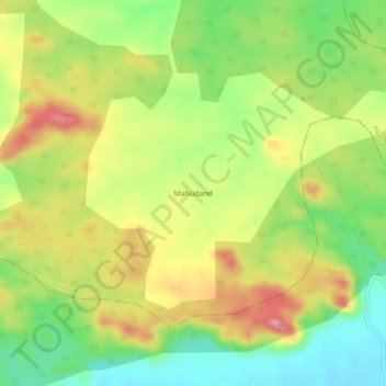
Name: Mahudand topographic map, elevation, terrain.
Location: Mahudand, Hussainabad, Palamu, Jharkhand, India (24.36244 84.00284 24.40244 84.04284)
Average elevation: 275 m
Minimum elevation: 214 m
Maximum elevation: 343 m
Thank you for supporting this site ❤️
Make a donation
Make a donation