
Thank you for supporting this site ❤️
Make a donation
Make a donation
Taft Heights topographic map
Click on the map to display elevation.
Thank you for supporting this site ❤️
Make a donation
Make a donation
Taft Heights
Taft Heights (formerly, Boust City) is a census-designated place (CDP) in Kern County, California, United States. Taft Heights is located 1 mile (1.6 km) west-southwest of Taft, at an elevation of 1,178 feet (359 m). The population was 1,949 at the 2010 census, up from 1,865 at the 2000 census.
Thank you for supporting this site ❤️
Make a donation
Make a donation
About this map
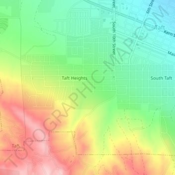
Name: Taft Heights topographic map, elevation, terrain.
Location: Taft Heights, Taft, Kern County, California, United States (35.12960 -119.47860 35.13679 -119.46470)
Average elevation: 368 m
Minimum elevation: 274 m
Maximum elevation: 493 m
Thank you for supporting this site ❤️
Make a donation
Make a donation