
Thank you for supporting this site ❤️
Make a donation
Make a donation
Waterloo topographic map
Click on the map to display elevation.
Thank you for supporting this site ❤️
Make a donation
Make a donation
About this map
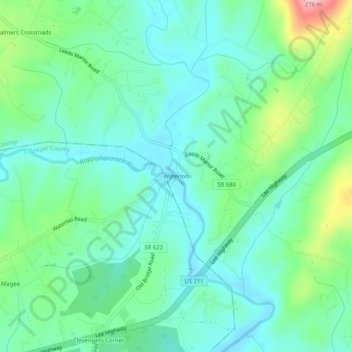
Name: Waterloo topographic map, elevation, terrain.
Location: Waterloo, Fauquier County, Virginia, United States (38.67595 -77.92611 38.71595 -77.88611)
Average elevation: 137 m
Minimum elevation: 94 m
Maximum elevation: 262 m
Thank you for supporting this site ❤️
Make a donation
Make a donation
Other topographic maps
Click on a map to view its topography, its elevation and its terrain.
Thank you for supporting this site ❤️
Make a donation
Make a donation
C.F. Phelps Wildlife Management Area
United States > Virginia > Fauquier County
Average elevation: 95 m
Thank you for supporting this site ❤️
Make a donation
Make a donation