Gnaw Bone topographic map
Interactive map
Click on the map to display elevation.
About this map
![Gnaw Bone topographic map, elevation, terrain](/pub/maps/node/mvmt/lxdbktp/thumbnail.jpg)
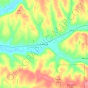
Name: Gnaw Bone topographic map, elevation, terrain.
Location: Gnaw Bone, Brown County, Indiana, United States (39.17088 -86.17555 39.21088 -86.13555)
Average elevation: 231 m
Minimum elevation: 184 m
Maximum elevation: 275 m
Other topographic maps
Click on a map to view its topography, its elevation and its terrain.
![Hesitation Point topographic map, elevation, terrain](/pub/maps/node/wdtf/llgwttzs/icon.jpg)
Hesitation Point
United States > Indiana > Brown County
Hesitation Point, Brown County, Indiana, 47448, United States
Average elevation: 253 m
![Helmsburg topographic map, elevation, terrain](/pub/maps/node/9k5k/wc5ggtf/icon.jpg)
Helmsburg
United States > Indiana > Brown County
Helmsburg, Brown County, Indiana, 47435, United States
Average elevation: 222 m
![Story topographic map, elevation, terrain](/pub/maps/node/rvtj/s9fwzmt/icon.jpg)
Story
United States > Indiana > Brown County
Story, Brown County, Indiana, United States
Average elevation: 195 m
![Pikes Peak topographic map, elevation, terrain](/pub/maps/node/blnx/brs3pt6/icon.jpg)
Pikes Peak
United States > Indiana > Brown County
Pikes Peak, Brown County, Indiana, United States
Average elevation: 219 m
![Needmore topographic map, elevation, terrain](/pub/maps/node/mg14/b2j26t6/icon.jpg)
Needmore
United States > Indiana > Brown County
Needmore, Brown County, Indiana, 47435, United States
Average elevation: 223 m
![Becks Grove topographic map, elevation, terrain](/pub/maps/node/h51/9qfjczs/icon.jpg)
Becks Grove
United States > Indiana > Brown County
Becks Grove, Brown County, Indiana, United States
Average elevation: 239 m
![Camp Roberts topographic map, elevation, terrain](/pub/maps/node/gd3l/xz7l7kl/icon.jpg)
Camp Roberts
United States > Indiana > Brown County
Camp Roberts, Brown County, Indiana, United States
Average elevation: 226 m
![Christiansburg topographic map, elevation, terrain](/pub/maps/node/fsgp/9qbt7zs/icon.jpg)
Christiansburg
United States > Indiana > Brown County
Christiansburg, Brown County, Indiana, United States
Average elevation: 217 m
![Fruitdale topographic map, elevation, terrain](/pub/maps/node/rb3q/b2zwdt6/icon.jpg)
Fruitdale
United States > Indiana > Brown County
Fruitdale, Brown County, Indiana, 46160, United States
Average elevation: 247 m
![Cornelius topographic map, elevation, terrain](/pub/maps/node/r5tj/kj51gb3/icon.jpg)
Cornelius
United States > Indiana > Brown County
Cornelius, Brown County, Indiana, 47435, United States
Average elevation: 242 m
![Clarksdale topographic map, elevation, terrain](/pub/maps/node/zttj/s9k8rgt/icon.jpg)
Clarksdale
United States > Indiana > Brown County
Clarksdale, Brown County, Indiana, United States
Average elevation: 242 m
![Mount Liberty topographic map, elevation, terrain](/pub/maps/node/3v9m/fxtxf1h/icon.jpg)
Mount Liberty
United States > Indiana > Brown County
Mount Liberty, Brown County, Indiana, United States
Average elevation: 241 m
![Lanam topographic map, elevation, terrain](/pub/maps/node/kjt6/kjg86b3/icon.jpg)
Lanam
United States > Indiana > Brown County
Lanam, Brown County, Indiana, 47435, United States
Average elevation: 242 m
![Kirkofer Lake Dam topographic map, elevation, terrain](/pub/maps/node/rwtj/pqqnrcmt/icon.jpg)
Kirkofer Lake Dam
United States > Indiana > Brown County
Kirkofer Lake Dam, Brown County, Indiana, United States
Average elevation: 241 m
![Belmont topographic map, elevation, terrain](/pub/maps/node/msm2/xz7h9kl/icon.jpg)
Belmont
United States > Indiana > Brown County
Belmont, Brown County, Indiana, United States
Average elevation: 196 m
![Elkinsville topographic map, elevation, terrain](/pub/maps/node/83m2/jvxcl5k/icon.jpg)
Elkinsville
United States > Indiana > Brown County
Elkinsville, Brown County, Indiana, United States
Average elevation: 200 m
![Gatesville topographic map, elevation, terrain](/pub/maps/node/h6gt/51qf357/icon.jpg)
Gatesville
United States > Indiana > Brown County
Gatesville, Brown County, Indiana, United States
Average elevation: 238 m
![Peoga topographic map, elevation, terrain](/pub/maps/node/tddn/s9h9zmt/icon.jpg)
Peoga
United States > Indiana > Brown County
Peoga, Brown County, Indiana, 46164, United States
Average elevation: 280 m
![Stone Head topographic map, elevation, terrain](/pub/maps/node/3d1h/skv15mt/icon.jpg)
Stone Head
United States > Indiana > Brown County
Stone Head, Brown County, Indiana, United States
Average elevation: 214 m
![Spearsville topographic map, elevation, terrain](/pub/maps/node/3bdn/dgmgkz4/icon.jpg)
Spearsville
United States > Indiana > Brown County
Spearsville, Brown County, Indiana, United States
Average elevation: 271 m
![Trevlac topographic map, elevation, terrain](/pub/maps/node/4jtp/znkn5nx/icon.jpg)
Trevlac
United States > Indiana > Brown County
Trevlac, Brown County, Indiana, 47435, United States
Average elevation: 214 m
![Taggart topographic map, elevation, terrain](/pub/maps/node/dcgp/fw4bx1h/icon.jpg)
Taggart
United States > Indiana > Brown County
Taggart, Brown County, Indiana, United States
Average elevation: 237 m
![Beanblossom topographic map, elevation, terrain](/pub/maps/node/w957/9qsz34s/icon.jpg)
Beanblossom
United States > Indiana > Brown County
Beanblossom, Brown County, Indiana, 47435, United States
Average elevation: 233 m