
Thank you for supporting this site ❤️
Make a donation
Make a donation
Malaking Ilog topographic map
Click on the map to display elevation.
Thank you for supporting this site ❤️
Make a donation
Make a donation
About this map
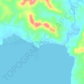
Name: Malaking Ilog topographic map, elevation, terrain.
Location: Malaking Ilog, Masbate, Bicol Region, Philippines (12.98002 123.03266 13.02002 123.07266)
Average elevation: 26 m
Minimum elevation: 0 m
Maximum elevation: 167 m
Thank you for supporting this site ❤️
Make a donation
Make a donation
Other topographic maps
Click on a map to view its topography, its elevation and its terrain.