
Thank you for supporting this site ❤️
Make a donation
Make a donation
Galongen topographic map
Click on the map to display elevation.
Thank you for supporting this site ❤️
Make a donation
Make a donation
About this map
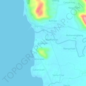
Name: Galongen topographic map, elevation, terrain.
Location: Galongen, La Union, Ilocos Region, 2525, Philippines (16.73613 120.32058 16.77613 120.36058)
Average elevation: 11 m
Minimum elevation: 0 m
Maximum elevation: 137 m
Thank you for supporting this site ❤️
Make a donation
Make a donation
Other topographic maps
Click on a map to view its topography, its elevation and its terrain.