
Thank you for supporting this site ❤️
Make a donation
Make a donation
Udange topographic map
Click on the map to display elevation.
Thank you for supporting this site ❤️
Make a donation
Make a donation
About this map
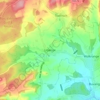
Name: Udange topographic map, elevation, terrain.
Location: Udange, Arlon, Luxembourg, Wallonia, 6700, Belgium (49.61750 5.75264 49.65750 5.79264)
Average elevation: 338 m
Minimum elevation: 286 m
Maximum elevation: 414 m
Thank you for supporting this site ❤️
Make a donation
Make a donation