
Thank you for supporting this site ❤️
Make a donation
Make a donation
Pine Knot topographic map
Click on the map to display elevation.
Thank you for supporting this site ❤️
Make a donation
Make a donation
About this map
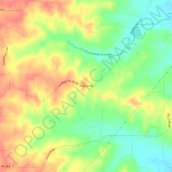
Name: Pine Knot topographic map, elevation, terrain.
Location: Pine Knot, Greene County, Arkansas, United States (36.00840 -90.61789 36.04840 -90.57789)
Average elevation: 131 m
Minimum elevation: 100 m
Maximum elevation: 159 m
Thank you for supporting this site ❤️
Make a donation
Make a donation
Other topographic maps
Click on a map to view its topography, its elevation and its terrain.