
九龙山乡 topographic map
Interactive map
Click on the map to display elevation.
About this map
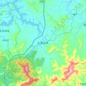
Name: 九龙山乡 topographic map, elevation, terrain.
Location: 九龙山乡, 渝水区, 新余市, 江西省, 中国 (27.58573 114.79165 27.70358 114.88555)
Average elevation: 147 m
Minimum elevation: 61 m
Maximum elevation: 487 m
Other topographic maps
Click on a map to view its topography, its elevation and its terrain.