
Saint-Théophrède topographic map
Interactive map
Click on the map to display elevation.
About this map
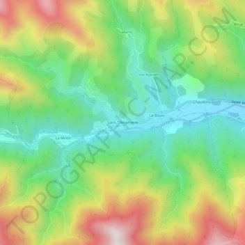
Name: Saint-Théophrède topographic map, elevation, terrain.
Average elevation: 707 m
Minimum elevation: 418 m
Maximum elevation: 1,159 m
Other topographic maps
Click on a map to view its topography, its elevation and its terrain.
La Motte
France > Auvergne-Rhône-Alpes > Ardèche > Barnas
La Motte, Barnas, Largentière, Ardèche, Auvergne-Rhône-Alpes, France métropolitaine, 07330, France
Average elevation: 752 m