
Thank you for supporting this site ❤️
Make a donation
Make a donation
Amburgey topographic map
Click on the map to display elevation.
Thank you for supporting this site ❤️
Make a donation
Make a donation
About this map
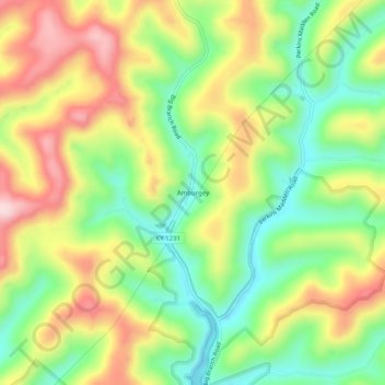
Name: Amburgey topographic map, elevation, terrain.
Location: Amburgey, Knott County, Kentucky, United States (37.24149 -83.01850 37.28149 -82.97850)
Average elevation: 443 m
Minimum elevation: 307 m
Maximum elevation: 611 m
Thank you for supporting this site ❤️
Make a donation
Make a donation
Other topographic maps
Click on a map to view its topography, its elevation and its terrain.