
Thank you for supporting this site ❤️
Make a donation
Make a donation
Hırkatepe topographic map
Click on the map to display elevation.
Thank you for supporting this site ❤️
Make a donation
Make a donation
About this map
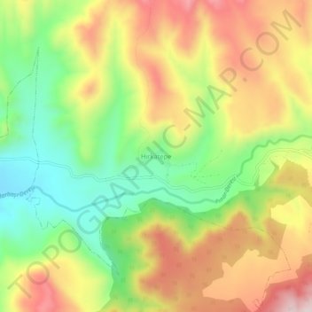
Name: Hırkatepe topographic map, elevation, terrain.
Location: Hırkatepe, Beypazarı, Ankara, Central Anatolia Region, Turkey (40.17783 31.73439 40.21783 31.77439)
Average elevation: 939 m
Minimum elevation: 711 m
Maximum elevation: 1,191 m
Thank you for supporting this site ❤️
Make a donation
Make a donation