
Thank you for supporting this site ❤️
Make a donation
Make a donation
Tikhi topographic map
Click on the map to display elevation.
Thank you for supporting this site ❤️
Make a donation
Make a donation
About this map
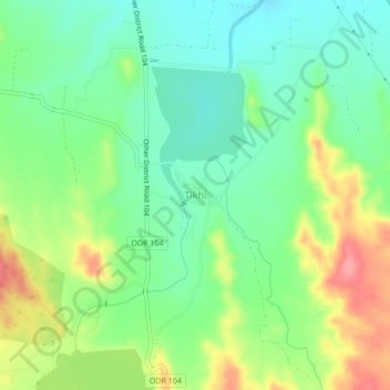
Name: Tikhi topographic map, elevation, terrain.
Location: Tikhi, Dhule, Maharashtra, India (20.78559 74.76385 20.82559 74.80385)
Average elevation: 336 m
Minimum elevation: 301 m
Maximum elevation: 396 m
Thank you for supporting this site ❤️
Make a donation
Make a donation
Other topographic maps
Click on a map to view its topography, its elevation and its terrain.