
Thank you for supporting this site ❤️
Make a donation
Make a donation
Talang Empat topographic map
Click on the map to display elevation.
Thank you for supporting this site ❤️
Make a donation
Make a donation
About this map
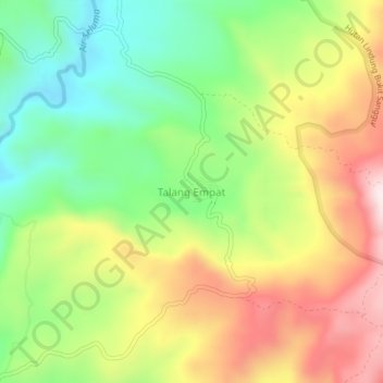
Name: Talang Empat topographic map, elevation, terrain.
Location: Talang Empat, Seluma, Bengkulu, Sumatra, Indonesia (-4.00622 102.64465 -3.96622 102.68465)
Average elevation: 486 m
Minimum elevation: 237 m
Maximum elevation: 793 m
Thank you for supporting this site ❤️
Make a donation
Make a donation
Other topographic maps
Click on a map to view its topography, its elevation and its terrain.