
Thank you for supporting this site ❤️
Make a donation
Make a donation
Lubuk Sikaping topographic map
Click on the map to display elevation.
Thank you for supporting this site ❤️
Make a donation
Make a donation
About this map
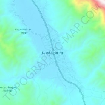
Name: Lubuk Sikaping topographic map, elevation, terrain.
Location: Lubuk Sikaping, Pasaman, West Sumatra, Sumatra, Indonesia (0.09244 100.12830 0.17244 100.20830)
Average elevation: 635 m
Minimum elevation: 428 m
Maximum elevation: 2,221 m
Thank you for supporting this site ❤️
Make a donation
Make a donation