
Thank you for supporting this site ❤️
Make a donation
Make a donation
Wytham Woods topographic map
Click on the map to display elevation.
Thank you for supporting this site ❤️
Make a donation
Make a donation
About this map
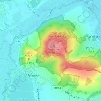
Name: Wytham Woods topographic map, elevation, terrain.
Average elevation: 84 m
Minimum elevation: 57 m
Maximum elevation: 167 m
Thank you for supporting this site ❤️
Make a donation
Make a donation
Other topographic maps
Click on a map to view its topography, its elevation and its terrain.
Farmoor
United Kingdom > England > Oxfordshire > Vale of White Horse > Farmoor
Average elevation: 81 m