
Thank you for supporting this site ❤️
Make a donation
Make a donation
Cougar topographic map
Click on the map to display elevation.
Thank you for supporting this site ❤️
Make a donation
Make a donation
About this map
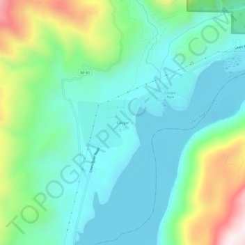
Name: Cougar topographic map, elevation, terrain.
Location: Cougar, Cowlitz County, Washington, 98616, United States (46.03126 -122.32242 46.07126 -122.28242)
Average elevation: 311 m
Minimum elevation: 131 m
Maximum elevation: 830 m
Thank you for supporting this site ❤️
Make a donation
Make a donation
Other topographic maps
Click on a map to view its topography, its elevation and its terrain.