
Thank you for supporting this site ❤️
Make a donation
Make a donation
Chushul topographic map
Click on the map to display elevation.
Thank you for supporting this site ❤️
Make a donation
Make a donation
About this map
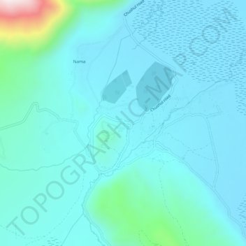
Name: Chushul topographic map, elevation, terrain.
Location: Chushul, Leh Tehsil, Leh district, Ladakh, India (33.58122 78.62306 33.62122 78.66306)
Average elevation: 4,395 m
Minimum elevation: 4,315 m
Maximum elevation: 4,974 m
Thank you for supporting this site ❤️
Make a donation
Make a donation