
Thank you for supporting this site ❤️
Make a donation
Make a donation
Troy topographic map
Click on the map to display elevation.
Thank you for supporting this site ❤️
Make a donation
Make a donation
About this map
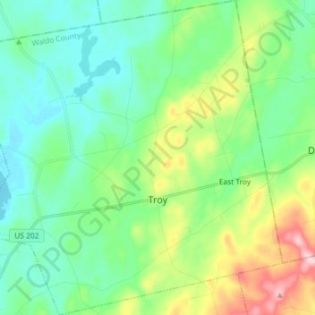
Name: Troy topographic map, elevation, terrain.
Location: Troy, Waldo County, Maine, 04987, United States (44.62713 -69.32741 44.72960 -69.18373)
Average elevation: 122 m
Minimum elevation: 51 m
Maximum elevation: 318 m
Thank you for supporting this site ❤️
Make a donation
Make a donation
Other topographic maps
Click on a map to view its topography, its elevation and its terrain.