
Thank you for supporting this site ❤️
Make a donation
Make a donation
Duanesburg topographic map
Click on the map to display elevation.
Thank you for supporting this site ❤️
Make a donation
Make a donation
Duanesburg
The town consists of mostly wooded hills up to an elevation of approximately 1,400 feet (430 m) above sea level. Most of the town was cleared farmland until the late 20th century. After this point forests grew to cover 60% of the total land area with a canopy higher than 40 feet (12 m). The forest is primary composed of poplar, hemlock, oak, maple, white pine, and balsam fir. The maximum tree heights in Duanesburg are approximately 80 feet (24 m) high.
Thank you for supporting this site ❤️
Make a donation
Make a donation
About this map
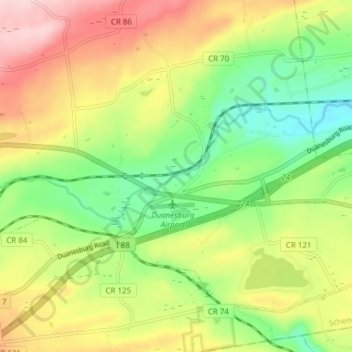
Name: Duanesburg topographic map, elevation, terrain.
Average elevation: 267 m
Minimum elevation: 154 m
Maximum elevation: 410 m
Thank you for supporting this site ❤️
Make a donation
Make a donation