
Thank you for supporting this site ❤️
Make a donation
Make a donation
Rome topographic map
Click on the map to display elevation.
Thank you for supporting this site ❤️
Make a donation
Make a donation
About this map
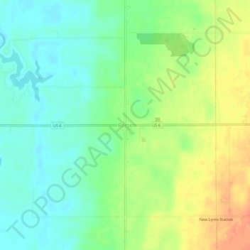
Name: Rome topographic map, elevation, terrain.
Location: Rome, Ashtabula County, Ohio, 44085, United States (41.58540 -80.88509 41.62540 -80.84509)
Average elevation: 258 m
Minimum elevation: 239 m
Maximum elevation: 284 m
Thank you for supporting this site ❤️
Make a donation
Make a donation
Other topographic maps
Click on a map to view its topography, its elevation and its terrain.
Thank you for supporting this site ❤️
Make a donation
Make a donation
Thank you for supporting this site ❤️
Make a donation
Make a donation