
Ashley County topographic map
Interactive map
Click on the map to display elevation.
About this map
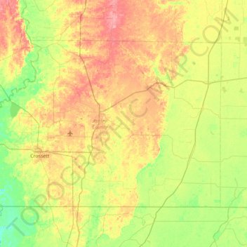
Name: Ashley County topographic map, elevation, terrain.
Location: Ashley County, Arkansas, United States (33.00618 -92.14372 33.39530 -91.45733)
Average elevation: 41 m
Minimum elevation: 11 m
Maximum elevation: 82 m
Other topographic maps
Click on a map to view its topography, its elevation and its terrain.