
Thank you for supporting this site ❤️
Make a donation
Make a donation
Dhandhuka topographic map
Click on the map to display elevation.
Thank you for supporting this site ❤️
Make a donation
Make a donation
Dhandhuka
Dhandhuka is located at 22°22′N 71°59′E / 22.37°N 71.98°E / 22.37; 71.98. It has an average elevation of 24 metres (78 feet). The city is 105 km from District center Ahmedabad, on state highway No 1. to Bhavnagar. Bhavnagar is 95 km from Dhandhuka town.
Thank you for supporting this site ❤️
Make a donation
Make a donation
About this map
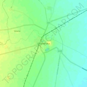
Name: Dhandhuka topographic map, elevation, terrain.
Average elevation: 21 m
Minimum elevation: 13 m
Maximum elevation: 30 m
Thank you for supporting this site ❤️
Make a donation
Make a donation