
Thank you for supporting this site ❤️
Make a donation
Make a donation
Khatling topographic map
Click on the map to display elevation.
Thank you for supporting this site ❤️
Make a donation
Make a donation
About this map
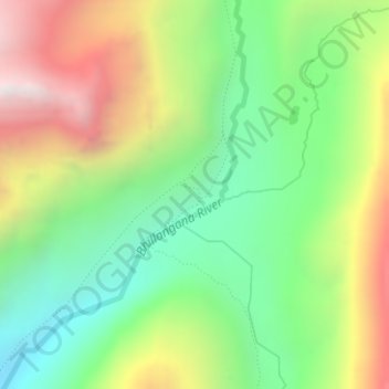
Name: Khatling topographic map, elevation, terrain.
Location: Khatling, Ghansali, Tehri Garhwal, Uttarakhand, India (30.77380 78.93930 30.79380 78.95930)
Average elevation: 3,844 m
Minimum elevation: 3,287 m
Maximum elevation: 4,664 m
Thank you for supporting this site ❤️
Make a donation
Make a donation