
Thank you for supporting this site ❤️
Make a donation
Make a donation
Villaviciosa topographic map
Click on the map to display elevation.
Thank you for supporting this site ❤️
Make a donation
Make a donation
About this map
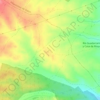
Name: Villaviciosa topographic map, elevation, terrain.
Location: Villaviciosa, Navalcarnero, Comunidad de Madrid, 28600, España (40.30496 -3.98440 40.32496 -3.96440)
Average elevation: 623 m
Minimum elevation: 583 m
Maximum elevation: 659 m
Thank you for supporting this site ❤️
Make a donation
Make a donation