
Thank you for supporting this site ❤️
Make a donation
Make a donation
Jones Island topographic map
Click on the map to display elevation.
Thank you for supporting this site ❤️
Make a donation
Make a donation
About this map
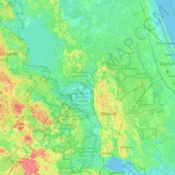
Name: Jones Island topographic map, elevation, terrain.
Location: Jones Island, Volusia County, Florida, United States (28.80220 -81.70868 29.44220 -81.06868)
Average elevation: 13 m
Minimum elevation: -3 m
Maximum elevation: 59 m
Thank you for supporting this site ❤️
Make a donation
Make a donation
Other topographic maps
Click on a map to view its topography, its elevation and its terrain.