
Make a donation
Paskenta topographic map
Click on the map to display elevation.
Make a donation
Paskenta
Paskenta (Wintun: Paskenti) is a small unincorporated town in Tehama County, California. Historically, it had greater local importance due to the presence of an active lumber mill. The ZIP Code is 96074. The community is inside area code 530 and the Paskenta CDP. Paskenta sits at an elevation of 725 feet (221 m). The 2010 United States census reported Paskenta's population was 112. Paskenta was originally inhabited by a tribe of Nomlaki people who are now part of the federally-recognized Paskenta Band of Nomlaki Indians.
Make a donation
About this map
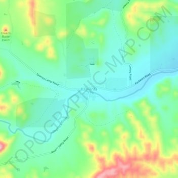
Name: Paskenta topographic map, elevation, terrain.
Location: Paskenta, Tehama County, California, 96074, United States (39.86429 -122.56697 39.90429 -122.52697)
Average elevation: 268 m
Minimum elevation: 213 m
Maximum elevation: 389 m
Make a donation
Other topographic maps
Click on a map to view its topography, its elevation and its terrain.