
Thank you for supporting this site ❤️
Make a donation
Make a donation
Air Kubang topographic map
Click on the map to display elevation.
Thank you for supporting this site ❤️
Make a donation
Make a donation
About this map
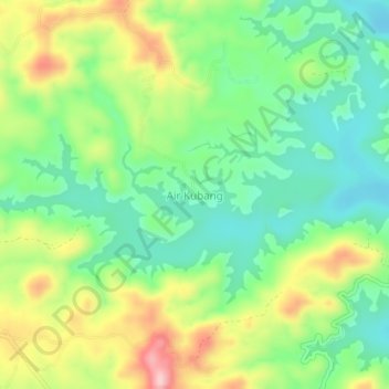
Name: Air Kubang topographic map, elevation, terrain.
Location: Air Kubang, Tanggamus, Lampung, Sumatra, Indonesia (-5.25301 104.72264 -5.21301 104.76264)
Average elevation: 307 m
Minimum elevation: 223 m
Maximum elevation: 446 m
Thank you for supporting this site ❤️
Make a donation
Make a donation
Other topographic maps
Click on a map to view its topography, its elevation and its terrain.