
Thank you for supporting this site ❤️
Make a donation
Make a donation
Laurel Fork topographic map
Click on the map to display elevation.
Thank you for supporting this site ❤️
Make a donation
Make a donation
About this map
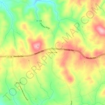
Name: Laurel Fork topographic map, elevation, terrain.
Location: Laurel Fork, Carroll County, Virginia, 24352, United States (36.69764 -80.53868 36.73764 -80.49868)
Average elevation: 832 m
Minimum elevation: 744 m
Maximum elevation: 918 m
Thank you for supporting this site ❤️
Make a donation
Make a donation
Other topographic maps
Click on a map to view its topography, its elevation and its terrain.