
桑堆镇 topographic map
Interactive map
Click on the map to display elevation.
About this map
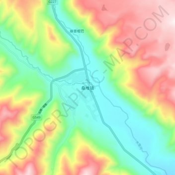
Name: 桑堆镇 topographic map, elevation, terrain.
Location: 桑堆镇, 稻城县, 甘孜藏族自治州, 四川省, 中国 (29.15453 100.06641 29.23453 100.14641)
Average elevation: 4,244 m
Minimum elevation: 3,897 m
Maximum elevation: 4,743 m
Other topographic maps
Click on a map to view its topography, its elevation and its terrain.