
Thank you for supporting this site ❤️
Make a donation
Make a donation
Melendreros topographic map
Click on the map to display elevation.
Thank you for supporting this site ❤️
Make a donation
Make a donation
About this map
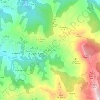
Name: Melendreros topographic map, elevation, terrain.
Location: Melendreros, Bimenes, Asturias, 33529, España (43.29176 -5.55351 43.33176 -5.51351)
Average elevation: 674 m
Minimum elevation: 317 m
Maximum elevation: 1,221 m
Thank you for supporting this site ❤️
Make a donation
Make a donation
Other topographic maps
Click on a map to view its topography, its elevation and its terrain.