
Thank you for supporting this site ❤️
Make a donation
Make a donation
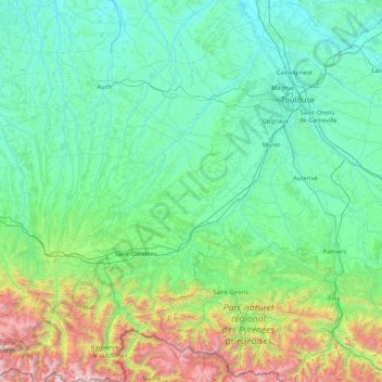
Haute-Garonne topographic map
Click on the map to display elevation.
Thank you for supporting this site ❤️
Make a donation
Make a donation
Haute-Garonne
The department is crossed by the upper course of the Garonne river (hence the name) for nearly 200 kilometers (120 mi). The borders of the department follow the river. The Garonne enters France from Spain at the town of Fos, and goes through Toulouse and leaves the department. The extreme south of the department lies in the Pyrenees mountain range and is very mountainous. The highest elevation is the Peak of Perdiguère, at 3,222 meters (10,571 feet) above sea level.
Thank you for supporting this site ❤️
Make a donation
Make a donation
About this map
Name: Haute-Garonne topographic map, elevation, terrain.
Location: Haute-Garonne, Occitania, Metropolitan France, France (42.68959 0.44195 43.92164 2.04829)
Average elevation: 536 m
Minimum elevation: 79 m
Maximum elevation: 3,202 m
Thank you for supporting this site ❤️
Make a donation
Make a donation