
Thank you for supporting this site ❤️
Make a donation
Make a donation
Altdorfer Wald topographic map
Click on the map to display elevation.
Thank you for supporting this site ❤️
Make a donation
Make a donation
Altdorfer Wald
Der Altdorfer Wald zwischen Aulendorf und Vogt im baden-württembergischen Landkreis Ravensburg ist ein bis 776,9 m ü. NHN hoher, bewaldeter Höhenzug.
Thank you for supporting this site ❤️
Make a donation
Make a donation
About this map
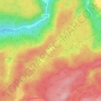
Name: Altdorfer Wald topographic map, elevation, terrain.
Average elevation: 590 m
Minimum elevation: 492 m
Maximum elevation: 653 m
Thank you for supporting this site ❤️
Make a donation
Make a donation