
Thank you for supporting this site ❤️
Make a donation
Make a donation
Hiram Cook Lake topographic map
Click on the map to display elevation.
Thank you for supporting this site ❤️
Make a donation
Make a donation
About this map
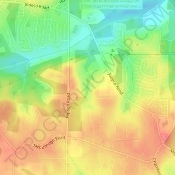
Name: Hiram Cook Lake topographic map, elevation, terrain.
Location: Hiram Cook Lake, Henry County, Georgia, United States (33.48464 -84.24213 33.48877 -84.24027)
Average elevation: 248 m
Minimum elevation: 213 m
Maximum elevation: 276 m
Thank you for supporting this site ❤️
Make a donation
Make a donation
Other topographic maps
Click on a map to view its topography, its elevation and its terrain.
Thank you for supporting this site ❤️
Make a donation
Make a donation
Thank you for supporting this site ❤️
Make a donation
Make a donation