
Thank you for supporting this site ❤️
Make a donation
Make a donation
Linwood Park topographic map
Click on the map to display elevation.
Thank you for supporting this site ❤️
Make a donation
Make a donation
About this map
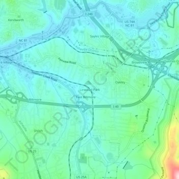
Name: Linwood Park topographic map, elevation, terrain.
Average elevation: 654 m
Minimum elevation: 607 m
Maximum elevation: 855 m
Thank you for supporting this site ❤️
Make a donation
Make a donation
Other topographic maps
Click on a map to view its topography, its elevation and its terrain.
Beaver Lake
United States > North Carolina > Buncombe County > Asheville > Grace
Average elevation: 672 m