
Thank you for supporting this site ❤️
Make a donation
Make a donation
Becket topographic map
Click on the map to display elevation.
Thank you for supporting this site ❤️
Make a donation
Make a donation
About this map
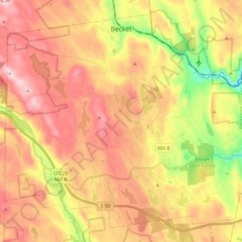
Name: Becket topographic map, elevation, terrain.
Average elevation: 480 m
Minimum elevation: 242 m
Maximum elevation: 670 m
Thank you for supporting this site ❤️
Make a donation
Make a donation
Other topographic maps
Click on a map to view its topography, its elevation and its terrain.
Camp Kingsmont
United States > Massachusetts > Berkshire County > West Stockbridge
Average elevation: 421 m