
Thank you for supporting this site ❤️
Make a donation
Make a donation
Loma Somera topographic map
Click on the map to display elevation.
Thank you for supporting this site ❤️
Make a donation
Make a donation
About this map
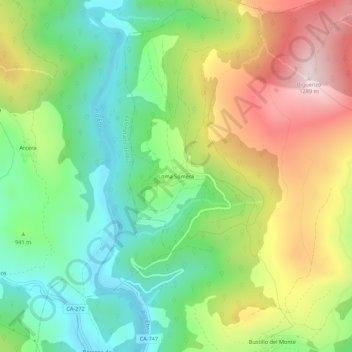
Name: Loma Somera topographic map, elevation, terrain.
Location: Loma Somera, Valderredible, Cantabria, 39419, España (42.85287 -4.04417 42.89287 -4.00417)
Average elevation: 959 m
Minimum elevation: 743 m
Maximum elevation: 1,279 m
Thank you for supporting this site ❤️
Make a donation
Make a donation
Other topographic maps
Click on a map to view its topography, its elevation and its terrain.