
Thank you for supporting this site ❤️
Make a donation
Make a donation
Gajah topographic map
Click on the map to display elevation.
Thank you for supporting this site ❤️
Make a donation
Make a donation
About this map
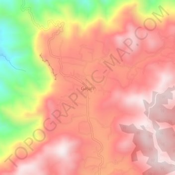
Name: Gajah topographic map, elevation, terrain.
Location: Gajah, Ponorogo, East Java, Java, Indonesia (-8.05621 111.48389 -8.01621 111.52389)
Average elevation: 788 m
Minimum elevation: 271 m
Maximum elevation: 1,044 m
Thank you for supporting this site ❤️
Make a donation
Make a donation
Other topographic maps
Click on a map to view its topography, its elevation and its terrain.