
Thank you for supporting this site ❤️
Make a donation
Make a donation
Tekonsha topographic map
Click on the map to display elevation.
Thank you for supporting this site ❤️
Make a donation
Make a donation
About this map
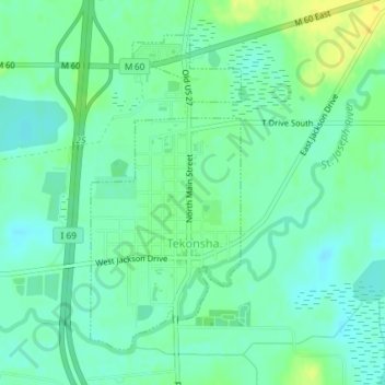
Name: Tekonsha topographic map, elevation, terrain.
Average elevation: 289 m
Minimum elevation: 280 m
Maximum elevation: 303 m
Thank you for supporting this site ❤️
Make a donation
Make a donation
Other topographic maps
Click on a map to view its topography, its elevation and its terrain.
Battle Creek
United States > Michigan > Calhoun County > Battle Creek > Battle Creek
Average elevation: 279 m
Thank you for supporting this site ❤️
Make a donation
Make a donation
Thank you for supporting this site ❤️
Make a donation
Make a donation