
Make a donation
Island Grove topographic map
Click on the map to display elevation.
Make a donation
About this map
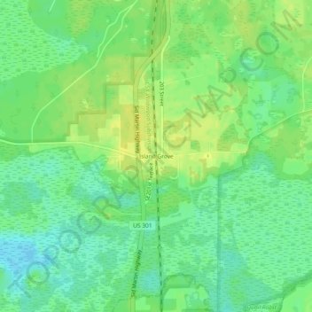
Name: Island Grove topographic map, elevation, terrain.
Location: Island Grove, Alachua County, Florida, 32654, United States (29.43358 -82.12648 29.47358 -82.08648)
Average elevation: 18 m
Minimum elevation: 7 m
Maximum elevation: 29 m
Make a donation
Other topographic maps
Click on a map to view its topography, its elevation and its terrain.
Gainesville
United States > Florida > Alachua County
Gainesville is situated in a region characterized by gently rolling hills and a mix of flatlands, typical of north-central Florida's terrain. The elevation ranges from approximately 50 to 200 feet above sea level, providing a scenic landscape dotted with lush vegetation and various waterways, including the…
Average elevation: 42 m
San Felasco Hammock Preserve State Park
United States > Florida > Alachua County > Alachua
Average elevation: 45 m
Make a donation
Make a donation
Make a donation
Make a donation