
Thank you for supporting this site ❤️
Make a donation
Make a donation
Malo topographic map
Click on the map to display elevation.
Thank you for supporting this site ❤️
Make a donation
Make a donation
About this map
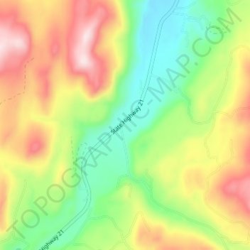
Name: Malo topographic map, elevation, terrain.
Location: Malo, Ferry County, Washington, 99160, United States (48.78156 -118.62697 48.82156 -118.58697)
Average elevation: 788 m
Minimum elevation: 624 m
Maximum elevation: 998 m
Thank you for supporting this site ❤️
Make a donation
Make a donation
Other topographic maps
Click on a map to view its topography, its elevation and its terrain.