
Seaford topographic map
Click on the map to display elevation.
About this map
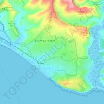
Name: Seaford topographic map, elevation, terrain.
Location: Seaford, Lewes, East Sussex, England, United Kingdom (50.75434 0.06667 50.80221 0.15447)
Average elevation: 28 m
Minimum elevation: -3 m
Maximum elevation: 130 m