
Thank you for supporting this site ❤️
Make a donation
Make a donation
Wangal topographic map
Click on the map to display elevation.
Thank you for supporting this site ❤️
Make a donation
Make a donation
About this map
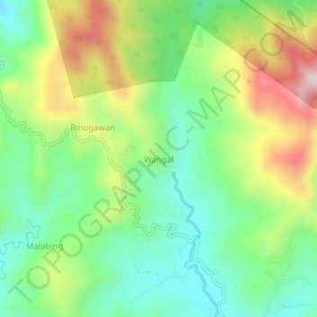
Name: Wangal topographic map, elevation, terrain.
Location: Wangal, Nueva Vizcaya, Cagayan Valley, Philippines (16.39140 121.36434 16.43140 121.40434)
Average elevation: 885 m
Minimum elevation: 691 m
Maximum elevation: 1,211 m
Thank you for supporting this site ❤️
Make a donation
Make a donation
Other topographic maps
Click on a map to view its topography, its elevation and its terrain.