Simonton Lake topographic map
Interactive map
Click on the map to display elevation.
About this map
![Simonton Lake topographic map, elevation, terrain](/pub/maps/relation/c8nx/m8fdn/thumbnail.jpg)
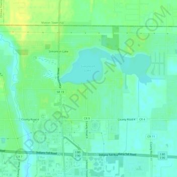
Name: Simonton Lake topographic map, elevation, terrain.
Location: Simonton Lake, Elkhart County, Indiana, United States (41.73135 -85.99580 41.76018 -85.94216)
Average elevation: 239 m
Minimum elevation: 231 m
Maximum elevation: 251 m
Other topographic maps
Click on a map to view its topography, its elevation and its terrain.
![Wakarusa topographic map, elevation, terrain](/pub/maps/relation/h4cz/3lptp/icon.jpg)
Wakarusa
United States > Indiana > Elkhart County
Wakarusa, Elkhart County, Indiana, 46573, United States
Average elevation: 257 m
![Dunlap topographic map, elevation, terrain](/pub/maps/relation/t63q/67wb3/icon.jpg)
Dunlap
United States > Indiana > Elkhart County
Dunlap, Elkhart County, Indiana, United States
Average elevation: 239 m
![Benton topographic map, elevation, terrain](/pub/maps/node/fzf3/9qdbvzs/icon.jpg)
Benton
United States > Indiana > Elkhart County
Benton, Elkhart County, Indiana, United States
Average elevation: 257 m
![Vistula topographic map, elevation, terrain](/pub/maps/node/hbgt/wczvdtf/icon.jpg)
Vistula
United States > Indiana > Elkhart County
Vistula, Elkhart County, Indiana, United States
Average elevation: 243 m
![Nappanee topographic map, elevation, terrain](/pub/maps/relation/k99m/p41m2/icon.jpg)
Nappanee
United States > Indiana > Elkhart County
Nappanee, Elkhart County, Indiana, 46550, United States
Average elevation: 261 m
![Goshen topographic map, elevation, terrain](/pub/maps/relation/fdmt/d73s8/icon.jpg)
Goshen
United States > Indiana > Elkhart County
Goshen, Elkhart County, Indiana, United States
Average elevation: 252 m
![New Paris topographic map, elevation, terrain](/pub/maps/relation/jct6/3lmgp/icon.jpg)
New Paris
United States > Indiana > Elkhart County
New Paris, Elkhart County, Indiana, United States
Average elevation: 251 m
![Middlebury topographic map, elevation, terrain](/pub/maps/relation/xwf3/vtccz/icon.jpg)
Middlebury
United States > Indiana > Elkhart County
Middlebury, Elkhart County, Indiana, United States
Average elevation: 266 m
![Elkhart topographic map, elevation, terrain](/pub/maps/relation/zc5k/8spmt/icon.jpg)
Elkhart
United States > Indiana > Elkhart County
Elkhart, Elkhart County, Indiana, United States
Average elevation: 235 m
![Bristol topographic map, elevation, terrain](/pub/maps/relation/qz57/kxfkl/icon.jpg)
Bristol
United States > Indiana > Elkhart County
Bristol, Elkhart County, Indiana, 46507, United States
Average elevation: 237 m
![Elkhart topographic map, elevation, terrain](/pub/maps/node/k91h/b2c55t6/icon.jpg)
Elkhart
United States > Indiana > Elkhart County > Elkhart
Elkhart, Elkhart County, Indiana, 46515, United States
Average elevation: 247 m