
Thank you for supporting this site ❤️
Make a donation
Make a donation
Longlier topographic map
Click on the map to display elevation.
Thank you for supporting this site ❤️
Make a donation
Make a donation
About this map
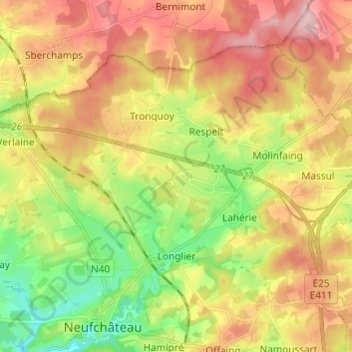
Name: Longlier topographic map, elevation, terrain.
Location: Longlier, Neufchâteau, Luxembourg, Wallonia, Belgium (49.84453 5.40837 49.90303 5.52942)
Average elevation: 467 m
Minimum elevation: 378 m
Maximum elevation: 558 m
Thank you for supporting this site ❤️
Make a donation
Make a donation