
Thank you for supporting this site ❤️
Make a donation
Make a donation
Napavine topographic map
Click on the map to display elevation.
Thank you for supporting this site ❤️
Make a donation
Make a donation
Napavine
A railroad depot was built in the late 1910s and provided passenger service until 1960. The Napavine Depot continued to serve the area until the station was permanently closed in April 1968 despite local protest. The Northern Pacific Railway station marked the highest elevation on the line between Portland and Seattle.
Thank you for supporting this site ❤️
Make a donation
Make a donation
About this map
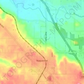
Name: Napavine topographic map, elevation, terrain.
Location: Napavine, Lewis County, Washington, 98565, United States (46.56761 -122.92283 46.61029 -122.88077)
Average elevation: 105 m
Minimum elevation: 61 m
Maximum elevation: 162 m
Thank you for supporting this site ❤️
Make a donation
Make a donation
Other topographic maps
Click on a map to view its topography, its elevation and its terrain.
Thank you for supporting this site ❤️
Make a donation
Make a donation
Thank you for supporting this site ❤️
Make a donation
Make a donation