
Thank you for supporting this site ❤️
Make a donation
Make a donation
Douro River topographic map
Click on the map to display elevation.
Thank you for supporting this site ❤️
Make a donation
Make a donation
About this map
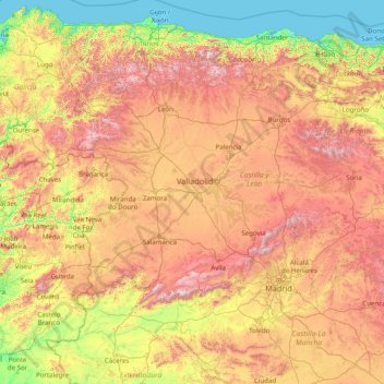
Name: Douro River topographic map, elevation, terrain.
Location: Douro River, 47359, Spain (41.02449 -8.67595 42.00718 -2.35864)
Average elevation: 698 m
Minimum elevation: -1 m
Maximum elevation: 2,482 m
Thank you for supporting this site ❤️
Make a donation
Make a donation
Other topographic maps
Click on a map to view its topography, its elevation and its terrain.