
Thank you for supporting this site ❤️
Make a donation
Make a donation
Somme topographic map
Click on the map to display elevation.
Thank you for supporting this site ❤️
Make a donation
Make a donation
About this map
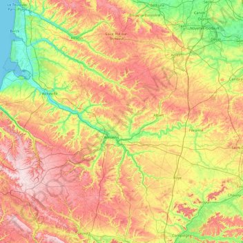
Name: Somme topographic map, elevation, terrain.
Location: Somme, Hauts-de-France, Metropolitan France, France (49.57178 1.37983 50.36634 3.20277)
Average elevation: 98 m
Minimum elevation: 0 m
Maximum elevation: 247 m
Thank you for supporting this site ❤️
Make a donation
Make a donation