
Thank you for supporting this site ❤️
Make a donation
Make a donation
Kothila topographic map
Click on the map to display elevation.
Thank you for supporting this site ❤️
Make a donation
Make a donation
About this map
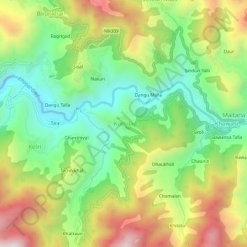
Name: Kothila topographic map, elevation, terrain.
Location: Kothila, Thailisain, Pauri Garhwal, Uttarakhand, 246276, India (29.80239 79.02526 29.84239 79.06526)
Average elevation: 1,514 m
Minimum elevation: 1,165 m
Maximum elevation: 2,009 m
Thank you for supporting this site ❤️
Make a donation
Make a donation
Other topographic maps
Click on a map to view its topography, its elevation and its terrain.