
Thank you for supporting this site ❤️
Make a donation
Make a donation
Mokihinui topographic map
Click on the map to display elevation.
Thank you for supporting this site ❤️
Make a donation
Make a donation
About this map
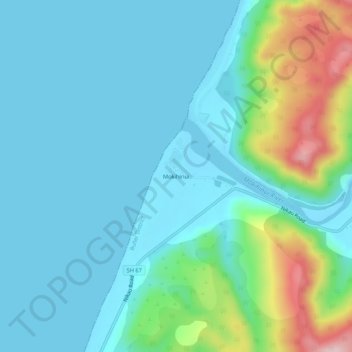
Name: Mokihinui topographic map, elevation, terrain.
Location: Mokihinui, Buller District, West Coast, New Zealand (-41.54774 171.91557 -41.50774 171.95557)
Average elevation: 55 m
Minimum elevation: -2 m
Maximum elevation: 274 m
Thank you for supporting this site ❤️
Make a donation
Make a donation
Other topographic maps
Click on a map to view its topography, its elevation and its terrain.